Live chat with an expert or send an email if we’re offline.
There are lots of ways to contact a librarian. Choose your way
Dana Health Sciences Library:
Howe Library:
Silver Special Collections Library:
Data is organized by theme, subfolder, data layer, specific file of larger data set where applicable.
All data layers listed below are available for download at Vermont Center for Geographic Information (VCGI).
Theme: Agriculture and Farming
Subfolder: Land
Data Layer: GeologicSoils_SO: soils- Natural Resource Conservation Service soil survey.
File: GeologicSoils_SO07.zip: Soils of Chittenden County, Vermont.
Theme: Basemaps (Scanned Map and Charts)
Subfolder: Scanned Maps
Data Layer: BasemapScanmaps_Topo24K: USGS Topographic Maps (1:24,000- New US Topo Maps)File:
File: US_Topo_Colchester_Point.zip: USGS Topographic Map of Colchester Point
Theme: Biological and Ecological
Subfolder: Habitat
Data Layer EcologicHabitat_HABITATBLKS: Vermont habitat blocks and wildlife corridors. (Areas of natural habitat that are unfragmented by roads, development, or agriculture.)
Data Layer EcologicHabitat_HOTSPOTS: Biological hotspots in Vermont. (Areas of high biological significance or diversity.)
Subfolder: Other
Data Layer: EcologicOther_RTENATCOM: (Rare, threatened and endangered species and significant communities in Vermont.)
Data Layer: EcologicOther_UNCOMSPOF: (Uncommon species and other features in Vermont.)
Theme: Fresh Water Resources
Subfolder: Wetlands
Data Layer: WaterWetlands_VSWI: Vermont Significant Wetlands Inventory (VSWI).
Theme: Geologic and Geophysical Limitations
Subfolder: Bedrock
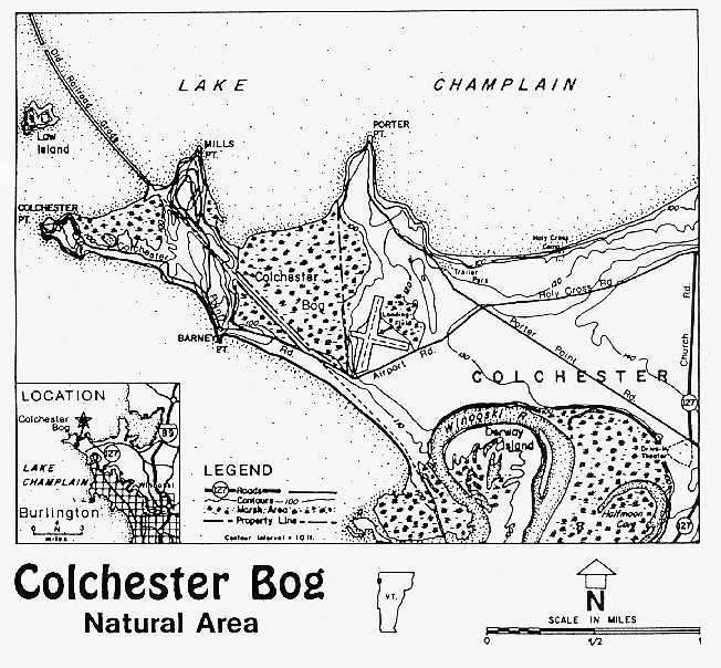
Data Layer: GeologicBedrock_BEDROCK9: Bedrock classification in Vermont.There are three classes (I= Carbonate Rich bedrock, II= Metamorphic Bedrock, III= Other) and 9 subclasses. Colchester Bog is Class I, Subclass 2: calcerous clastic and metamorphic clastic rocks containing approximately 15-45% carbonate material, including calcerous slates.
Subfolder: Landforms
Data Layer: GeologicSurficial_LANDFORMS: Landforms in Vermont.
Colchester Bog is classified as a wetland, and can be found as FID 55
Data Layer: GeologicSurficial_SURFICIAL62K: Surficial geology data- 1:62,500.
Colchester Bog can be found as FID 3522. Feature type= pluvial deposit, name/description= swamp, peat and/or muck.